


KAUNOS DALYAN 3
Main archeological sites
Kaunos is a site that is interesting for both its archeological and ecological importance. Situated in the Köyceğiz-Dalyan Special Environmental Protection Area, it offers outstanding vistas and is rich in wildlife. The ruins of the city are near Dalyan, on the west bank of the ancient Kalbis river. The main sights at the archeological site itself are as follows.
_edited.jpg)
Click on the pic. to zoom in
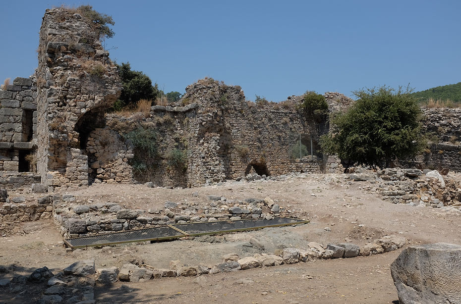
Temple in Kaunos / The obelisk was the symbol of king Kaunos,
The Acropolis
Acropolis (Persikon), situated on a 152 m high rock, fortified with Byzantine walls. The city's acropolis was called Imbros and it lay at the foot of Mount Tarbelos (present-day "Mount Ölemez").
Adjacent to the acropolis is a smaller fortification, called Heraklion. Until the 5th century BC this 50 m high cape reached into sea and there were two ports south and north of it. From the Acropolis there is a stunning view of the ancient city, Dalyan, the Dalyan river, the estuary and İztuzu Beach. From the small fortification, you look down on a traditional dalyan (fishing weir) situated quite near the former southern port.

Kaunos Lion

Coin From Kaunos
The Theater
The theater on the slope of the acropolis featuring both Hellenistic and Roman characteristics
The theater has a diameter of 75 m and was built at a 27-degree angle. It had a capacity for 5000 spectators and is in a fairly good state. It is still occasionally used for performances.

Click on the pic. to zoom in
Theater
The Palestra & Roman Baths
The palaestra with its Roman baths, a wind measuring platform and a domed Byzantine basilica
Archaeological research has shown that the palaestra was built over part of the old city that most probably had been a place of worship.
The Roman baths served as a social meeting place and were meant to impress the Kaunians — by their sheer dimensions — of the power of the Roman Empire. In the Byzantine era the baths were dismantled and the frigidarium was re-used as a church. The wind-measuring platform dates back to 150 BC and was used for city planning. According to the archeologists Öğün and Işık, it must have consisted of a circular building with a base diameter of 15.80 m and a top diameter of 13.70 m. The building has collapsed, however, probably as a result of an earthquake. The measuring method is therefore not quite clear. In his De architectura the Roman architect Vitruvius stated that wind-measuring platforms were used to plan streets in accordance with the prevailing wind direction, in order to keep the air in cities clean. The domed Byzantine basilica on the palaestra terrace dates back to the 5th century AD. It was made with building materials taken from previous buildings on a foundation belonging to a 4th-century building that was probably also used as a place of worship. The archeologist team think that its inner walls were plastered and decorated with frescoes. The domed basilica is the only remaining Byzantine edifice in Kaunos that still stands. Next to the basilica mosaics have been uncovered.
Click on the pic. to zoom in
The Palestra & Roman Baths
The port agora, the stoa and the nymphaeum
The port agora is located at the flat area in front of Sülüklü Lake. It dates back to the 4th century BC and kept its function as an economic, political and social meeting place until the end of the Roman era. The remains of pedestals indicate that there must have been many (bronze) statues of influential Romans, but these have not been found. Most likely these were melted down in the Byzantine era, for the archeologists found a smelting furnace of that period near to the pedestal of a bronze equestrial statue of the Roman governor of Asia, Lucius Licinius Murena. The covered stoa at the north side of the agora offered sun and rain protection. The stoa was created in the early Hellenistic era (3rd century BC), but part dates to the early Roman era. The Nympheon is also Hellenistic, but the fountain basin was extended during the Roman era. Inscriptions from the period of Emperor Hadrian reveal that the toll for merchants and boat owners was relaxed to compensate for the gradually silting port.

Rock tombs on the Dalyan river
Six rock tombs on the Dalyan river (4th – 2nd century BC), which are Dalyan's prime sight
The façades of the rock tombs resemble the fronts of Hellenistic temples with two Ionian pillars, a triangular pediment, an architrave with toothed friezes, and acroterions shaped like palm leaves.
The temples
Six temples have been excavated, two of Hellenistic and four of Roman origin. Probably the terrace temple of the 3rd century BC facing a circle of columns has the greatest appeal. Inside the circle an obelisk has been found, which is also depicted on old Kaunian coins. The obelisk was the symbol of king Kaunos, who according to mythology established the ancient city bearing his name.

.jpg)


